Gridded
Advertisement
GSSHA v.1.4.5.7
Gridded Surface Subsurface Hydrologic Analysis (GSSHA) is a grid-based two-dimensional hydrologic model.
Advertisement
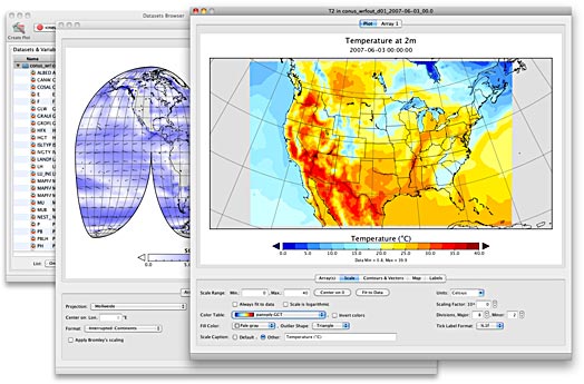
Panoply v.3.1.4 Build C6U1
Panoply is a cross-platform software which plots geo-gridded arrays from netCDF, HDF and GRIB datasets. Panoply is an utility that enable user to plot raster image. Depending on the data,
Panoply for Mac 3.1.7 Build CCX v.X
Panoply for Mac is a cross-platform application which plots geo-gridded arrays from netCDF, HDF and GRIB datasets.

Panoply 64bit 3.1.7 Build CCX v.X
Panoply 64bit is a cross-platform application which plots geo-gridded arrays from netCDF, HDF and GRIB datasets.

Panoply 3.1.7 Build CCX v.X
Panoply is a cross-platform application which plots geo-gridded arrays from netCDF, HDF and GRIB datasets.
Java Ocean Grid v.1.0
Java Ocean Grid (JOG) is a Java package which provides the user with a simple and effective object oriented approach to manipulating/analyzing gridded oceanographic and meteorological data.
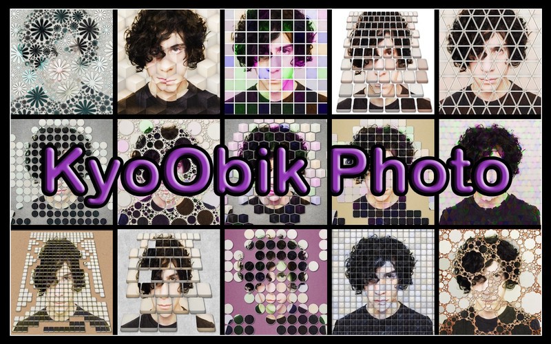
Kyoobic Photo v.1.20
The exploration into photo editing has led you to Kyoobik Photo (cubic), the photo app that turns your mundane photo into a geometric gridded image.
Digital Atmosphere v.3.0.0.1300
Digital Atmosphere is a powerful weather forecasting program that allows you to create detailed maps of real-time weather for anywhere in the world.
Integrated Data Viewer v.2 9
The Integrated Data Viewer (IDV) from Unidata is a Java™-based software framework. The IDV 'reference application' is a geoscience display and analysis software system with many of the standard data displays that other Unidata software (e.g.
Aarhus Workbench v.3 3
The Aarhus Workbench is a unique software package for handling, processing, inversion and visualization of geophysical and geological data.
ImageQuant TL v.1.1.0.1
Use one consistent and intuitive interface. ImageQuant TL is the most powerful, flexible and competitive general image analysis software available to the biotech community.